Krishi Vigyan Kendra (KVK) :: Krishi Vigyan Kendra (KVK), Ramanathapuram District
Area of Opertaion
Geographical details:
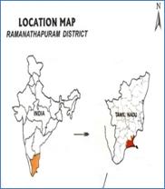
Ramanathapuram district has a long coastline of around 260 km. The coastal areas are flanked by Beach ridge complex-sand dunes, swamps and backwater. The sand flat is another feature of the coast comprising of clays and silts, often inundated by seawater and encrusted with salt. This district is bounded on the north by Sivagangai and Pudukottai districts, on the east and south by the Bay of Bengal, and on the west by Thoothukudi and Kamarajar districts. The district headquarters is located at Ramanathapuram.
Geographical area |
: |
4, 08, 957 ha |

|
Latitude |
: |
9005’-9056’ N |
Longitude |
: |
78010’-78027’ E |
Annual rainfall |
: |
827.0 mm |
Taluks of the district:
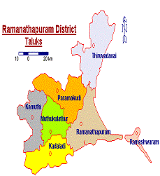
Ramanathapuram district comprises of seven taluks viz., Kadaladi, Kamuthi, Muthukulathur, Paramakudi, Ramanathapuram, Rameshwaram and Thiruvadanai
| Name of the Taluk |
Total area (ha) |
Taluk HQ |
Paramakudi |
73794 |
Paramakudi |
Rameshwaram |
9048 |
Rameshwaram |
Ramanathapuram |
77499 |
Ramanathapuram |
Thiruvadanai |
81461 |
Thiruvadanai |
Mudhukulathur |
48085 |
Mudhukulathur |
Kadaladi |
61223 |
Kadaladi |
Kamuthi |
57847 |
Kamuthi |
|

|
Blocks of the district:
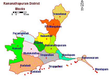
In Ramanathapuram District there are 11 Blocks viz., Kadaladi, Kamuthi, Muthukulathur, Bogalur, Nainarkoil, Paramakudi, Ramanathapuram,Thiruppullani and Mandapam.
| Name of the block |
Total area (ha) |
No. of Panchayat |
No. of villages |
Ramanathapuram |
214.08 |
25 |
25 |
Paramakudi |
290.60 |
39 |
34 |
R.S.Mangalam |
519.11 |
35 |
41 |
Thiruvadanai |
439.37 |
47 |
57 |
Kamuthi |
578.47 |
53 |
49 |
Nainarkoil |
273.04 |
37 |
36 |
Bogalur |
143.55 |
26 |
23 |
Mudukalathur |
396.23 |
46 |
38 |
Kadaladi |
686.95 |
60 |
53 |
Thirupullani |
28.83 |
33 |
25 |
Mandapam |
303.01 |
28 |
19 |
Source: Blockwise statistical report, office of the JDA, Ramanathapuram

|


